At a glance
- Flydalsjuvet sits at about 320 metres, the Eagle Road peaks at 620 metres at Korsmyra, and the summit of Dalsnibba reaches 1,476 metres.[3][5][6]
- The coach tour booked from this site stops at Flydalsjuvet, Dalsnibba, Djupvatnet and Eagle Bend, from US$116 for 3.5 hours.[1]
- The Dalsnibba toll road costs from 350 NOK for a car and from 180 NOK for a motorbike, paid online or at the gate.[7]
- Bus tours stop for 10 to 15 minutes at viewpoints, and an e-bike reaches Eagle Bend or Flydalsjuvet in about half an hour.[10]
- Dalsnibba is built to universal design with ramps, while Flydalsjuvet and Ørnesvingen are partially wheelchair accessible.[2][4][8]
| Dalsnibba | Flydalsjuvet | Ørnesvingen | |
|---|---|---|---|
| Height above sea level | Summit at 1,476 m[6] | About 320 m[3] | Top hairpin, below the road's 620 m high point[5] |
| From the village | 21 km, about 30 minutes[8] | About 4 km on road 63[3] | About 5 km, half an hour by e-bike[10] |
| Without a car | Bus tour, or e-bike with a large battery[10] | Bus tour stop or e-bike[10] | Bus tour stop or e-bike[10] |
| Main view | The fjord from the Skywalk platform[9] | Laushornet and Eidshornet peaks[2] | Seven Sisters and Knivsflå farm[4] |
| Wheelchair access | Universal design, with ramps[8] | Partially accessible[2] | Partially accessible[4] |
| Facilities | Café, shop and toilets[8] | Toilets, mid-May to mid-October[2] | Platform with its own waterfall[4] |
| On the Dalsnibba tour | Yes, a listed stop[1] | Yes, the first listed stop[1] | Yes, listed as Eagle Bend[1][5] |
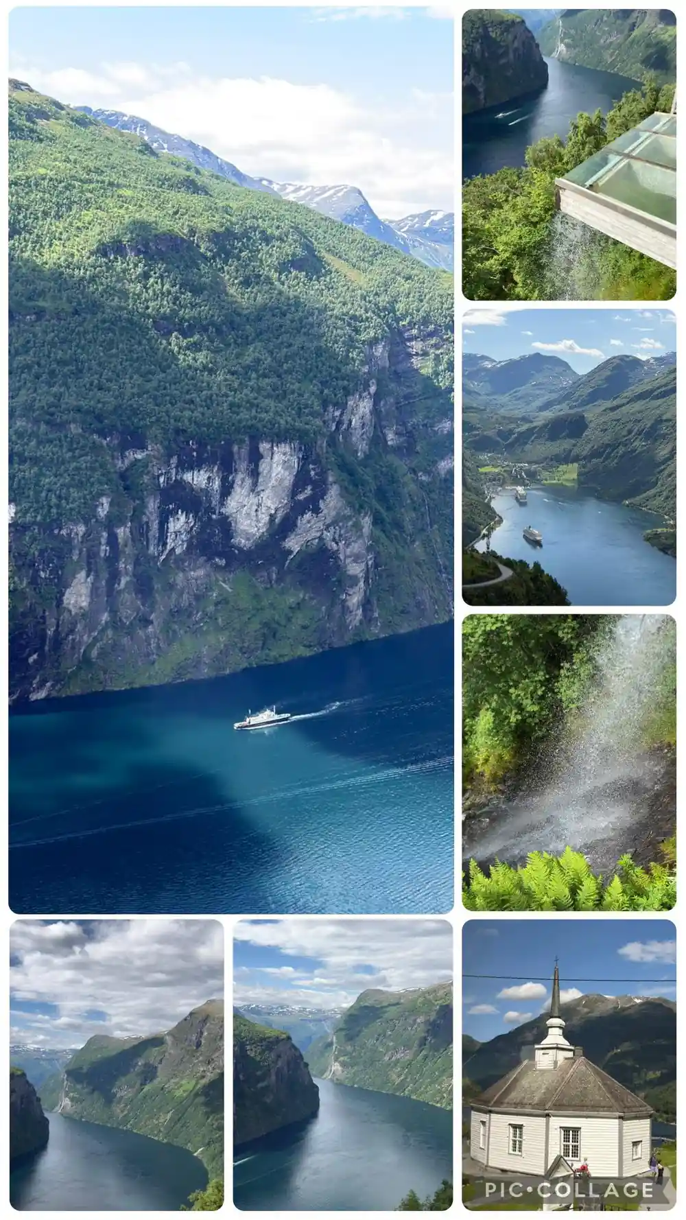
At the top lies the Ørnesvingen viewing point, with its own waterfall. From here the view opens towards Geiranger, across the Geirangerfjord with its near-perpendicular mountainsides, the “Seven Sisters” waterfalls and the Knivsflå mountain hamlet.
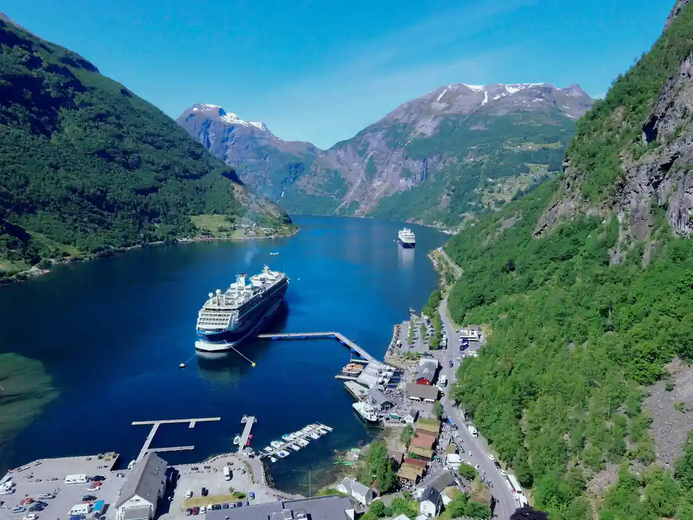
This rest area lies near the steep mountainside at the inner end of the Geirangerfjord and is one of many locations that offer spectacular vistas over the fjord.
Which viewpoint to choose if you only have time for one
Bring along
- Warm layers: the top of Dalsnibba can be 10 to 15 degrees colder than Geiranger.[8]
- A Dalsnibba toll ticket, bought online or at the gate, from 350 NOK a car.[7]
- The Dalsnibba road status on the day, as it can close at short notice.[7]
- A camera for morning or evening light, often the most dramatic at Dalsnibba.[8]
Know before you go
- Ramps lead from the Dalsnibba car park to the platform and buildings, and the toilets are accessible.[8]
- Flydalsjuvet and Ørnesvingen are partially wheelchair accessible.[2][4]
- Bus tours pause for 10 to 15 minutes at each viewpoint they visit.[10]
- Stay inside the fence at the Flydalsjuvet rock ledge.[3]
Dalsnibba, Flydalsjuvet and Ørnesvingen, far apart in height
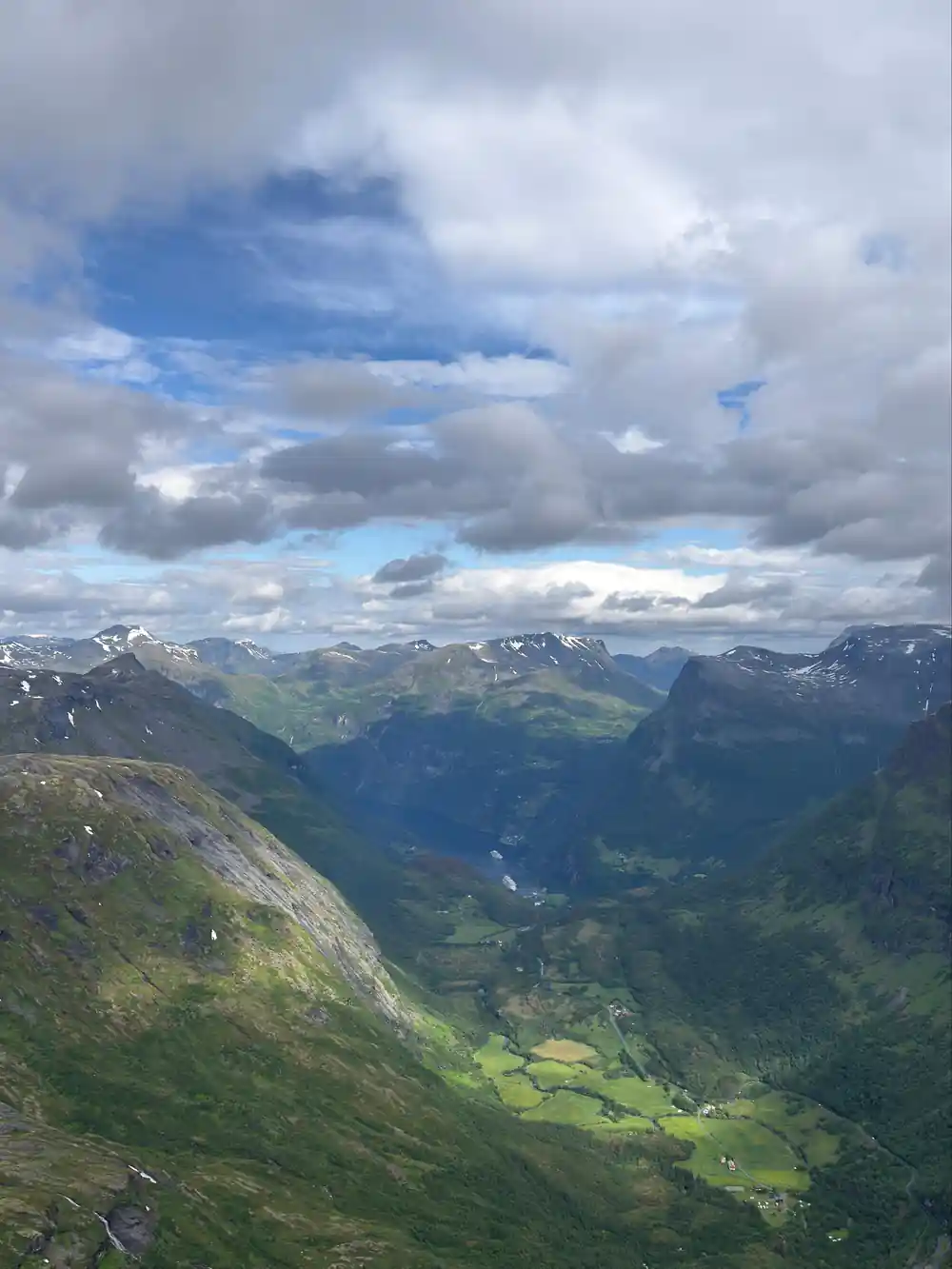
The best-known viewpoints look down on Geiranger from the roads above the village, and they sit at very different heights. Flydalsjuvet is about 320 metres above sea level, some 4 km from the village centre.[3] Ørnesvingen is the highest of the 11 hairpins on the Eagle Road, which climbs from the fjord towards Eidsdal and tops out at 620 metres at Korsmyra.[5] The summit of Dalsnibba stands at 1,476 metres.[6]
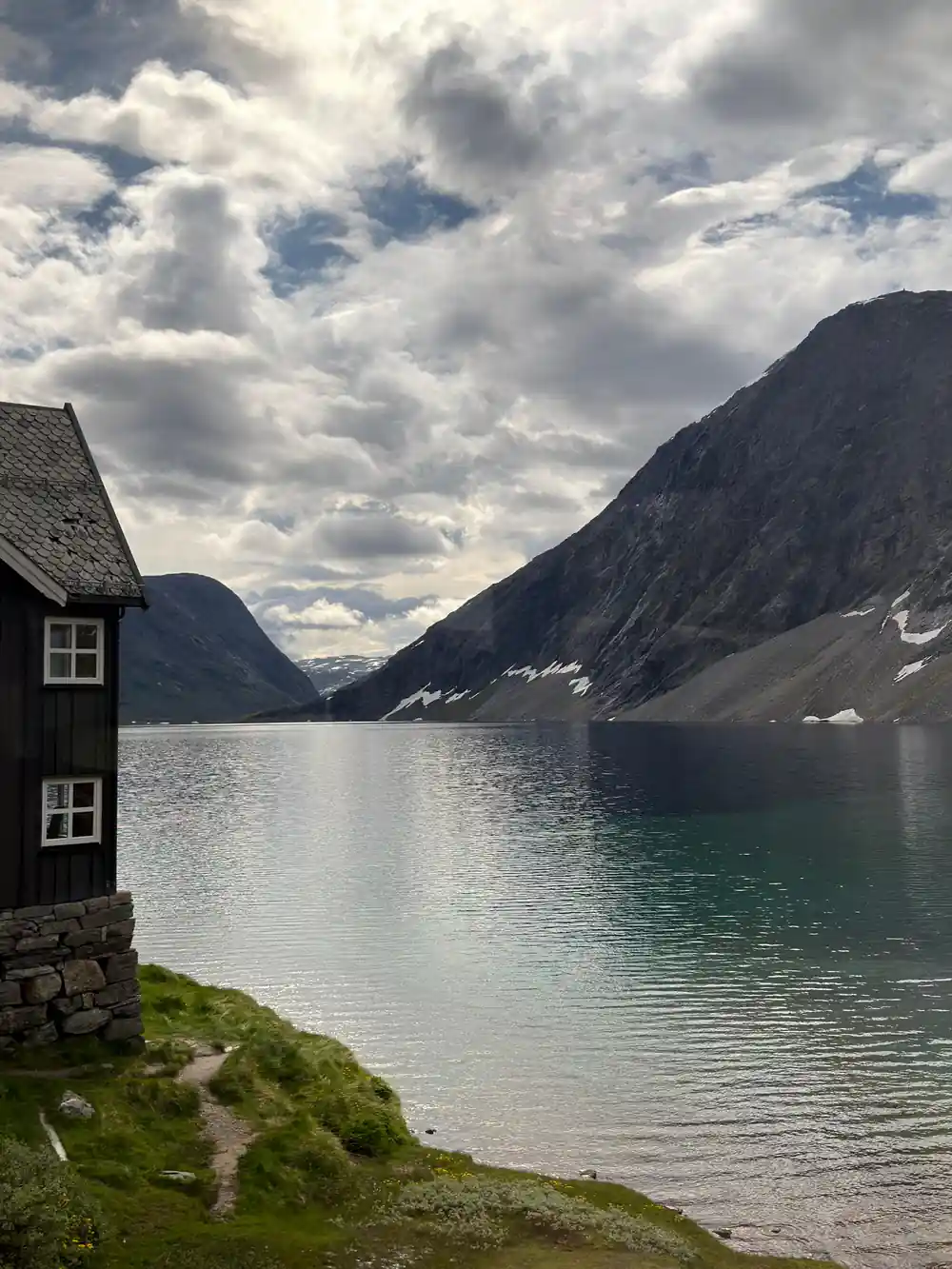
The Dalsnibba viewpoint sits behind a toll gate. The drive leaves Geiranger on county road 63 for 16 km, then climbs the last 5 km on Nibbevegen, a road with 11 hairpins of its own, which makes about 30 minutes from the centre to the top.[8]
The coach tour booked from this site stops at each of them. Its listed stops are Flydalsjuvet, Dalsnibba, Djupvatnet lake and Eagle Bend, the English name for the Ørnesvingen hairpin, over 3.5 hours from US$116.[1][5]
Dalsnibba and the Skywalk platform
The summit of Dalsnibba gives the highest Geirangerfjord aerial view you can reach by car. Its platform, Geiranger Skywalk, opened in 2016, and its owners call it Europe's highest fjord viewpoint reached by road, with a grated floor and glass railings that give a feeling of floating over the view.[9]
The car road to the top was ready in 1939. It is a private road owned and run by Geiranger Skysslag, a locally owned company, and the tickets bought at the gate pay for its upkeep and running.[6][9] Around 200,000 guests come up each year.[9] The toll is from 350 NOK for a car or motorhome, from 180 NOK for a motorbike and from 3,200 NOK for a bus.[7]
There is a café, a shop and toilets at the top, open from 09:30 to 17:00, and until 19:00 from 15 June to 15 August.[7] The whole site follows universal design, with wheelchair ramps from the car park to the platform and the buildings. A ticket is valid all day, and one bought in advance is refunded if weather closes the road.[8]
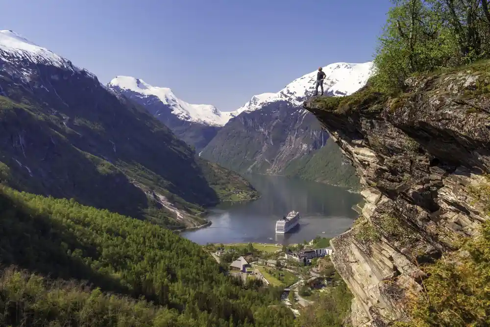
Looking down on Geiranger and its fjord from a viewing platform high above the valley
Where to find the best view of Geirangerfjord
Flydalsjuvet is split into an upper and a lower platform joined by a walkway, and from it you can see the 1,502-metre Laushornet and the 1,629-metre Eidshornet peaks.[2] At the Flydalsjuvet viewpoint, Geirangerfjord and the village lie below snow-capped mountains, and the scene is thought to be one of the most photographed in Norway.[3]
On the lower platform sits Fjordsetet, a seat also known as the Queen's Chair, unveiled by Queen Sonja in 2003. The small rock ledge where people pose for photographs lies beyond the fence, and visitors are asked not to climb over it; the same view of Geiranger and the fjord looks just as good without a person in the picture. Visitors ignoring the barriers are reported almost every summer, and the police do not like people putting themselves at risk there.[3]
From the Ørnesvingen viewpoint the view opens towards Geiranger and across the Geirangerfjord, with its near-vertical mountainsides, the Seven Sisters waterfalls and the Knivsflå mountain farm. The platform has its own waterfall and a glass decoration by the artist May Elin Eikaas-Bjerk. Both Ørnesvingen and Flydalsjuvet were designed by the architect 3RW, Sixten Rahlff, with Smedsvig Landskapsarkitekter on the landscape.[2][4]
The Eagle Road and its highest hairpin
The Eagle Road, Ørnevegen in Norwegian, climbs from the Geirangerfjord through 11 hairpin bends to 620 metres at Korsmyra. It was officially opened on 15 September 1955, and it gave Geiranger road access all year round.[5]
The name comes from the terrain at its highest point, which was traditionally home to a large number of eagles, and the road was an attraction from its first day. At its steepest it runs at one in ten, and the longest vehicle permitted on it is 15 metres. In winter the vehicle trade uses it as a test bed for road-holding.[5]
The viewpoint at the top hairpin was upgraded under the National Tourist Roads project and officially opened on 21 June 2006. From its platform you can also look down on the cruise ships moving on the fjord far below.[5] Eagle Bend is the last of the four stops listed for the Dalsnibba coach tour.[1]
1,476 m
The summit of Dalsnibba stands 1,476 metres above sea level, and the road that reaches it was ready in 1939.[6][9]
Which Geirangerfjord viewpoint suits limited mobility
Dalsnibba is the simplest of the three for a wheelchair user. You can drive all the way to the top, ramps lead from the car park to the platform and the buildings, and the toilets are accessible too.[8] Flydalsjuvet and Ørnesvingen are both listed as partially wheelchair accessible.[2][4]
At Flydalsjuvet the walkway between the upper and lower platforms is easy for everyone, and there are public toilets on site.[3] Those toilets are open from mid-May to mid-October.[2]
For a guided option with a wheelchair label, a small-group shore tour stops at Flydalsjuvet, Dalsnibba, the Skywalk and Djupvatnet in 3 hours, from US$124. It is listed as wheelchair accessible and rated 4.32 from 5 reviews.[13]
Viewpoints you can reach without a car
Bus tours leave from Geiranger itself, from outside the ticket office or the public bus station, and stop at viewpoints such as Eagle Bend, Flydalsjuvet and Dalsnibba, with photo breaks of 10 to 15 minutes each, the number depending on the tour. Their timetables follow the arrival and departure times of the cruise ships, so they change from day to day.[10] A shorter Dalsnibba mini bus tour runs 2 hours from US$116 with a guide speaking English and Norwegian.[14]
An e-bike is the other way up. Eagle Bend and Flydalsjuvet are each about 5 km and half an hour of cycling from the centre, while Dalsnibba is 21 km away and only suits bikes with large batteries.[10]
Vesterås, in the hillside 4 km by road from the centre and reachable on foot, by bike or by car, is the start of two short walks. The Vesteråsfjellet viewpoint, above vertical cliffs down to Geiranger, is about 30 minutes each way; its fence is loose, and children are not recommended there. A marked trail leads on to Løsta, around 500 metres above the fjord and about 60 minutes each way. From the same car park, a stone path climbs in 45 to 60 minutes to Storseterfossen, a waterfall you can walk behind.[11]
Timing the view, and a viewpoint further out
At Dalsnibba, morning and evening light often gives the most dramatic photographs. The weather on the summit can change quickly, so it pays to check the webcam before driving up and to wait a little if cloud rolls in. Snow often lies on the summit into June and July, and drones may only be flown over the car park and main area.[8]
The Dalsnibba road usually opens in mid-May and stays open into September or October. In 2025 it ran from 12 May to 3 October, while in 2020 it did not open until 12 June.[8] In season the road is open around the clock, but it closes at short notice when there is snow or ice on it.[7]
Further out, in Stranda municipality, a viewpoint on the path down to Ljøen looks over the Sunnylvsfjord towards Åkernesremna and into the Geirangerfjord. The family-friendly trail starts from the car park by the tunnel entrance in Strandadalen and climbs about 400 metres to Ljøbrekka, from where you can carry on down to Ljøen, at the other end of the tunnel.[12]
How high each viewpoint stands
Metres above sea level. The Eagle Road bar is the road's highest point, at Korsmyra.[3][5][6]
Price a guided trip to the viewpoints
Every figure is a "from" price for one adult and not a quote. Child prices may differ, so check the listing for your own party before you book.[1][13][14]
When the viewpoints are open
Planning a viewpoint day
Pick your viewpoints
Flydalsjuvet and Ørnesvingen sit on road 63, and Dalsnibba is 5 km up Nibbevegen, which leaves road 63.[3][5][8]
Check the Dalsnibba road
The toll road can close at short notice for snow or ice, even in season.[7]
Choose how to get up
Drive, hire an e-bike, or join a bus tour that stops for 10 to 15 minutes at each viewpoint.[10]
Pack for the summit
Bring warm layers: the top of Dalsnibba can be 10 to 15 degrees colder than Geiranger.[8]
Or let a guide do the driving
The Dalsnibba coach tour stops at Flydalsjuvet, Dalsnibba, Djupvatnet and Eagle Bend.[1]
See Flydalsjuvet, Dalsnibba and Eagle Bend on one guided coach tour
from US$117Reserve now & pay later