At a glance
- The Flydalsjuvet viewpoint height is about 320 metres above sea level, some 4 km from Geiranger centre on road 63 towards Grotli.[3][4]
- At the Flydalsjuvet rock viewpoint, a photo of a person on the ledge is near iconic, but it lies beyond the fence and visitors are asked not to climb over.[3]
- On the lower platform sits Fjordsetet, a seat unveiled by Queen Sonja in September 2003 for the 10th anniversary of Fjord Norge.[4]
- Knivsflå, 240 metres above the fjord, was abandoned in 1898; Skageflå, 250 metres up, was evacuated in 1916.[5][6][7]
- The coach tour booked from this site lists Flydalsjuvet first, then Dalsnibba, Djupvatnet and Eagle Bend, from US$116 for 3.5 hours.[1]
| On the coach tour | On foot from the village | By e-bike | |
|---|---|---|---|
| Time needed | 3.5 hours, four stops[1] | About 2.5 hours, with rappels[12] | 1 hour up, 30 minutes down[11] |
| Cost from | from US$116[1] | from 1,100 NOK per adult[12] | from 515 NOK, 2 hours of hire[11] |
| Getting up | Coach with a live English guide[1] | Guided hike on a roped trail[12] | 10 km return from the harbour[11] |
| At the viewpoint | The first of four listed stops[1] | A chance to pose on the cliff edge[12] | Back the same way to the harbour[11] |
| Recommended for | Adding Dalsnibba and Eagle Bend[1] | Active people without fear of heights[12] | Pausing wherever the view changes[11] |
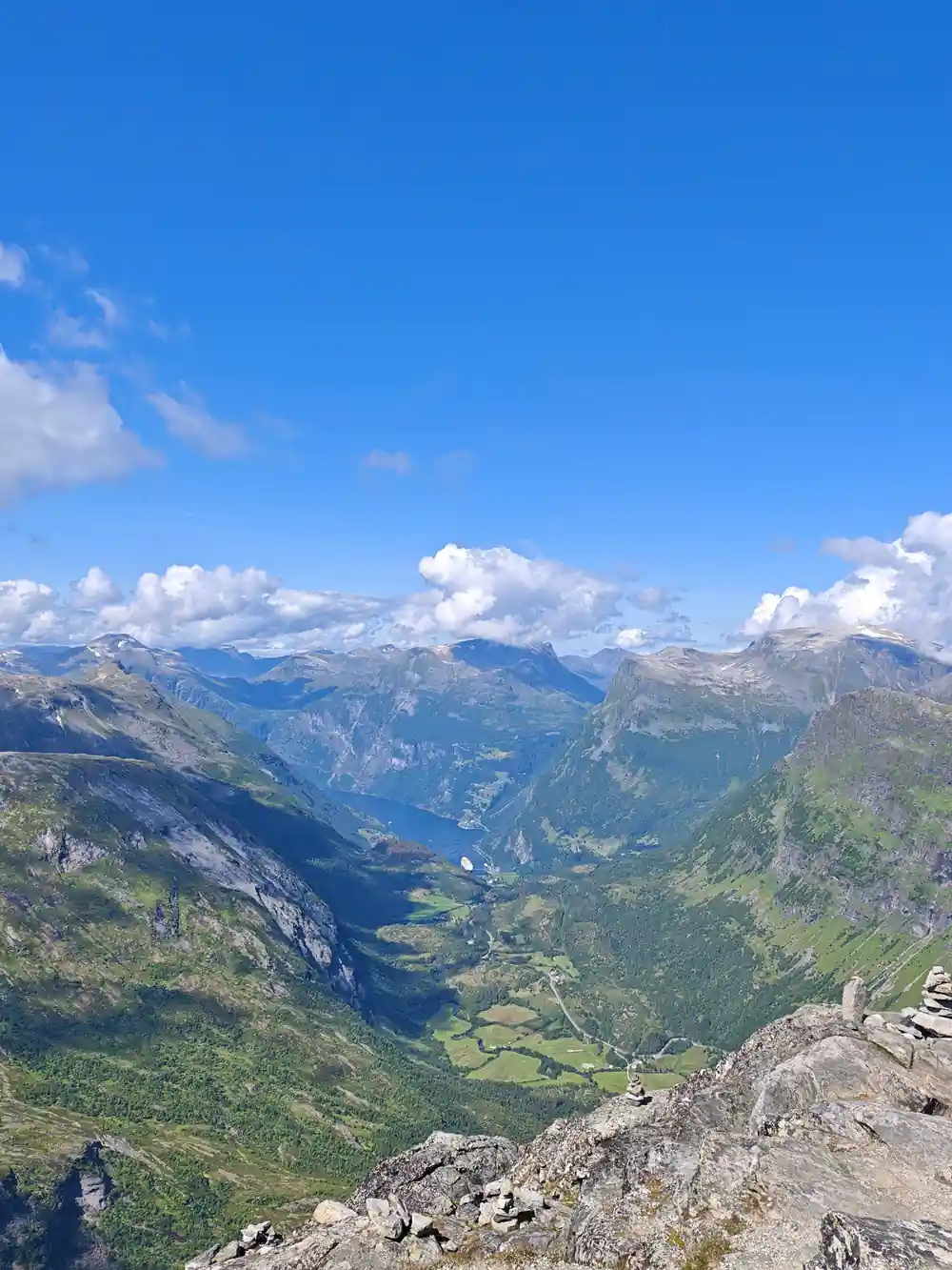
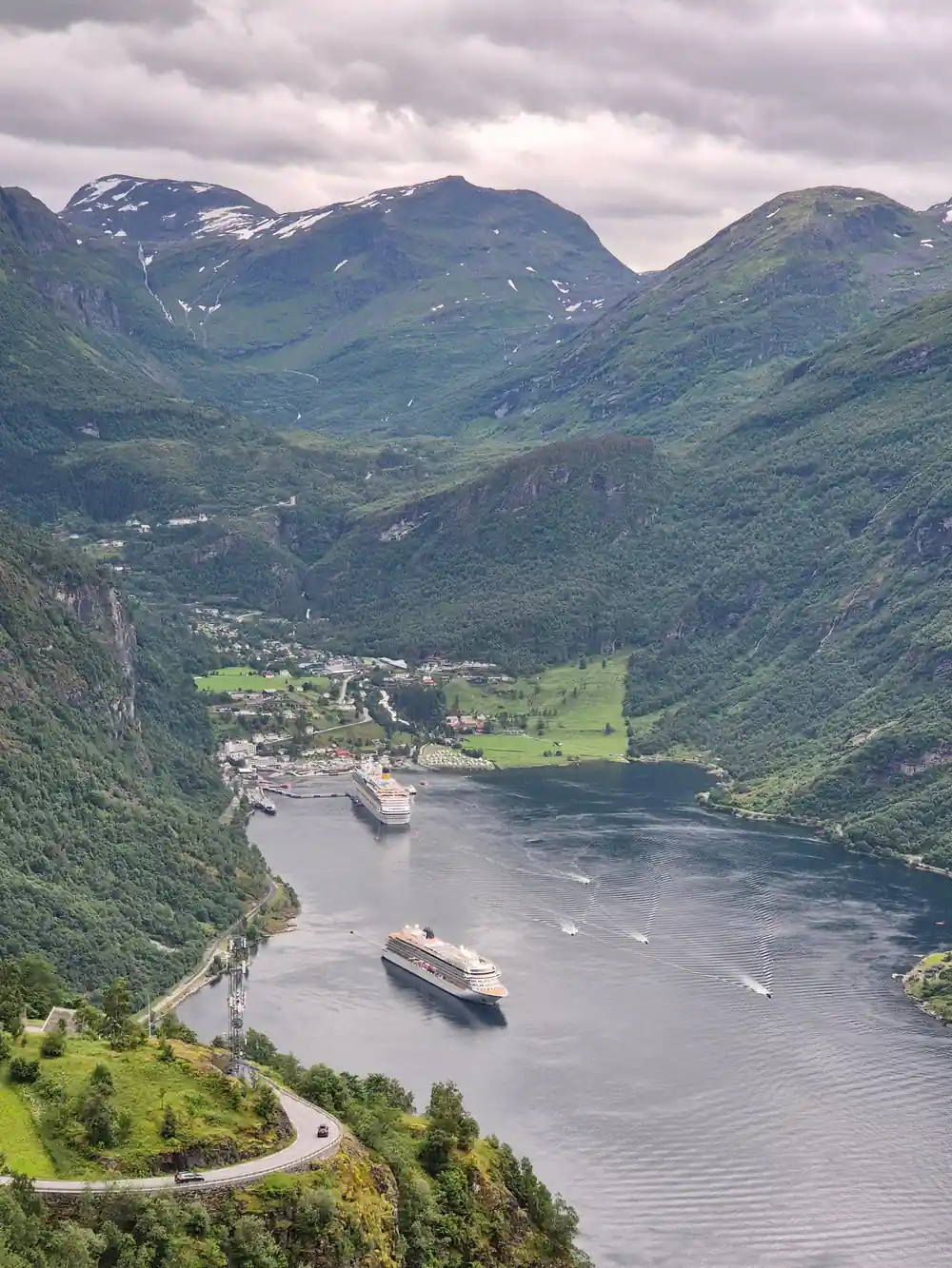
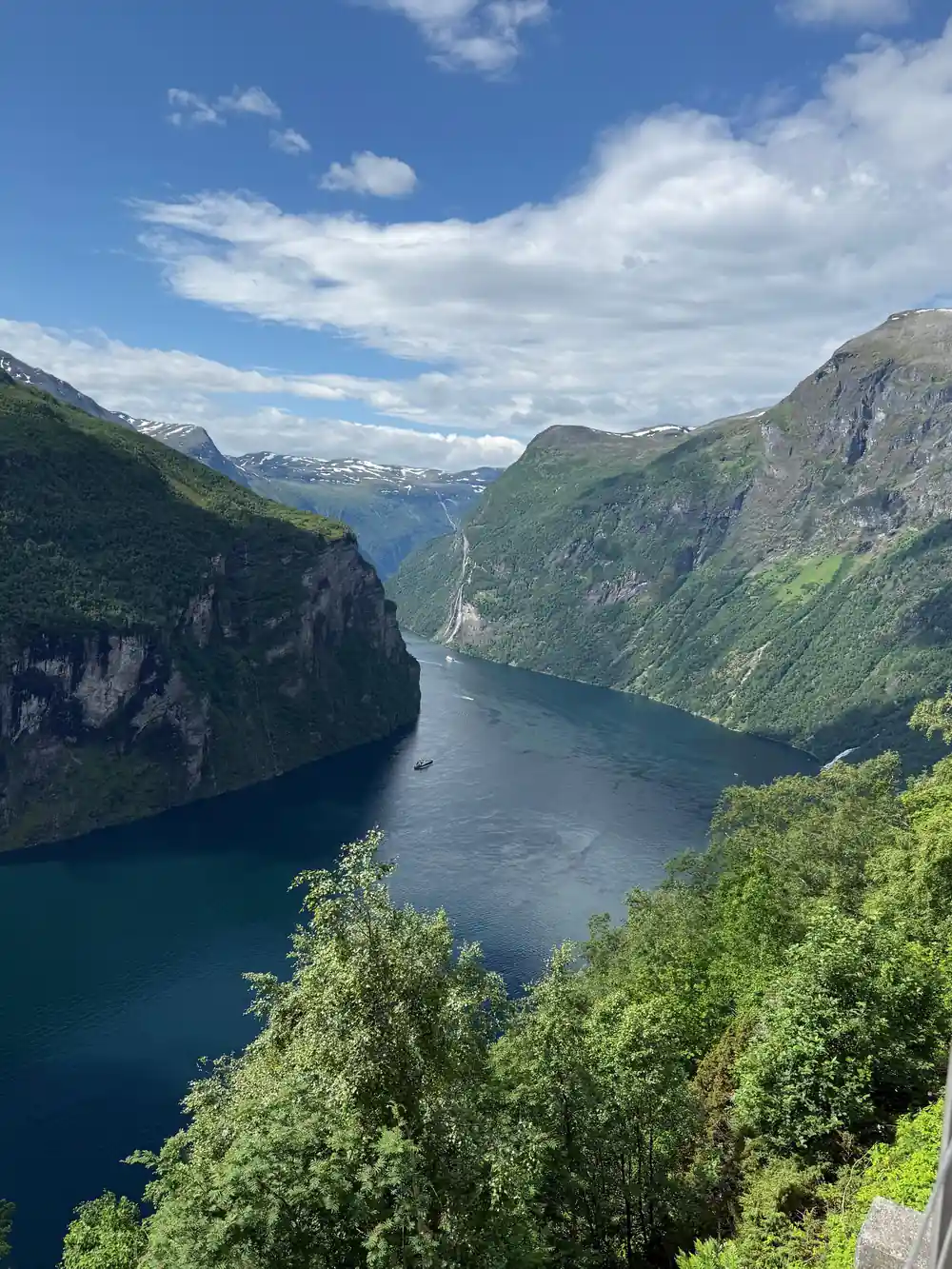
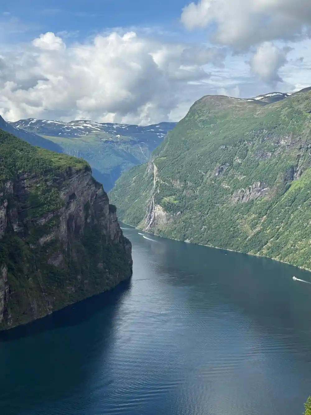
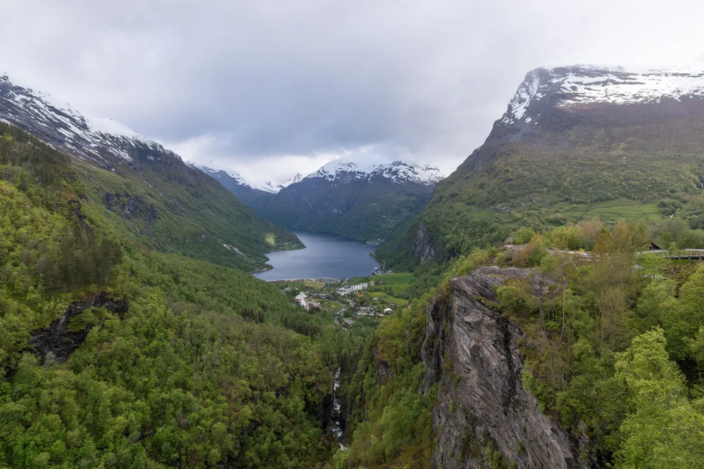
Flydalsjuvet offers an impressive view and is an excellent point for photography, with a view over Geiranger and Geirangerfjorden.
Skageflå was evacuated in 1916, but it continued to be harvested until the end of the 1960s.
How to see Flydalsjuvet and its cliff farms
At Flydalsjuvet
The Photograph That Made Flydalsjuvet Famous
Flydalsjuvet has become one of the most recognizable views in Norway, appearing in travel magazines, social media feeds, and bucket lists worldwide. The fame began decades ago when photographers discovered the precise angle from the viewpoint platform: a sweeping vista down the Geirangerfjord, framed by steep mountainsides and, most distinctively, a single dramatic rock formation that juts into the frame. The image captures something both wild and intimate about the Norwegian fjords.
What makes it truly iconic is not just the landscape itself, but the vantage point from which it is seen. When you stand at the Flydalsjuvet viewpoint hike and look out across the canyon, you understand immediately why this single perspective has travelled the globe. The rock catches light differently at different times of day, and photographers queue here during golden hour hoping to capture the exact conditions that made earlier images legendary.
The tour stops at this viewpoint as part of a guided circuit through Geiranger's most photographed locations. From the platform, about 320 metres above sea level, you look out over Geiranger and the Geirangerfjord.[3][4] The vantage point offers unobstructed views of the water far below, the U-shaped valley walls, and on clear days, the glaciers that feed the fjord's waterfalls. The platform itself is modest and accessible, designed for visitors to step out and spend time composing shots or simply absorbing the scale of the landscape. The famous rock that appears in countless photographs is visible from this exact spot, creating the sense of depth and drama that has made this location internationally renowned.
Understanding the Flydalsjuvet Canyon and the Geiranger Rock
The word Flydalsjuvet is pronounced 'FLEW-dahls-yoo-vet' (with the stress on the first syllable), and it translates roughly to 'the mountain cleft of Flydal'. The name refers not to a single feature but to the entire gorge and outcrop system visible from the viewpoint. The Geirangerfjord itself is a UNESCO World Heritage site, carved by glaciers over thousands of years into a narrow, deep valley where waterfalls plunge directly from clifftops to the water.
The distinctive rock formation that dominates photographs is a natural outcropping of the mountainside, sculpted by ice age erosion and now standing as a solitary pinnacle. It is not separate from the mountain but an extension of it, a jutting point where harder stone has resisted weathering better than the surrounding rock. Local guides call this formation the Geiranger rock, and it has become so associated with Flydalsjuvet that many visitors mistakenly believe the rock and the viewpoint are the same feature.
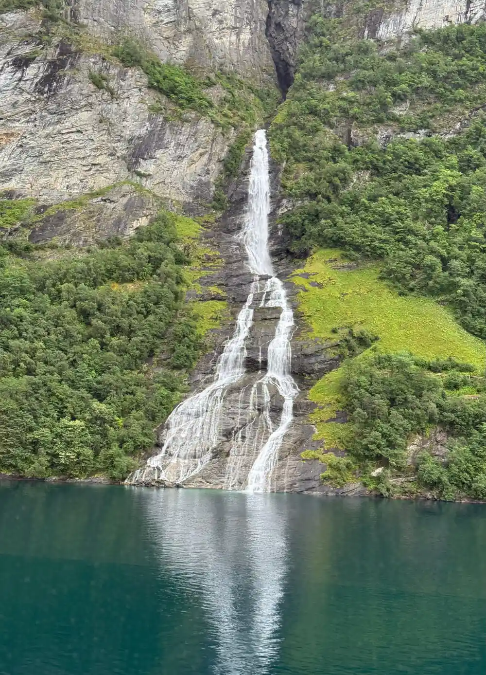
The fjord's geology tells a story spanning hundreds of thousands of years. Glaciers grinding through the valley left behind steep vertical walls, some rising more than 1,500 metres from water level to summit. The canyon system channeled meltwater into streams and waterfalls, some of which still flow from mountain springs during the summer months. The viewpoint itself sits on a plateau that offers a completely different perspective from the fjord settlements below. Standing there, you see the fjord not as a traveller moving through it, but as an observer suspended above it, able to comprehend its true scale and the severity of the terrain that surrounds it.
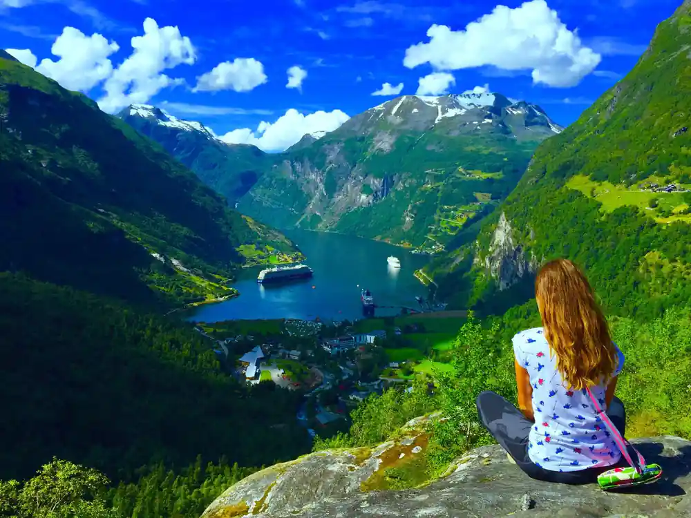
Geiranger and its fjord below the steep mountainsides around Flydalsjuvet
The Cliff Farms: Skageflå and Knivsflå
Out along the fjord, directly across the water from each other, are the remnants of two farms that once clung impossibly to the mountainside: Skageflå and Knivsflå.[7] These were not farms in any conventional sense. They occupied narrow ledges on near-vertical cliffs, accessed only by steep footpaths and, in winter, by rope and ladder.
Skageflå sits about 250 metres above the fjord and Knivsflå about 240 metres.[5][7] The Knivsflå hamlet is in the view from Ørnesvingen, the Eagle Bend stop on the coach tour, dwarfed by the rock above and below it.[1][9] Few structures in Europe exist in such extreme locations, and fewer still were inhabited year-round. Yet families lived there, farmed there, and raised children there for generations.
Life and Farming on the Fjord Ledges
Families at Skageflå and Knivsflå were subsistence farmers in the truest sense. They kept goats and sheep, around 120 dairy goats at Skageflå at its peak, that foraged on the narrow grassland between rock and cliff edge.[5] Haymaking was a seasonal crisis; every scrap of vegetation had to be gathered and dried during the brief summer months. Cows were kept at lower elevations during winter, brought up only when the cliff pastures had adequate growth.
The farms produced some dairy goods, which were carried down the mountain on footpaths to be sold in the settlements around Geiranger. In summer, the isolation was tolerable; the long daylight hours, the cooler temperatures at altitude, and access to spring water made survival possible. Families supplemented farming with fishing in the fjord and gathering wild berries and plants from the mountainside.
The daily reality of cliff farming was brutally physical. Every meal required carrying water and supplies along narrow paths where a slip meant death. Births needed help brought over the mountain: on Christmas Day 1892 a 77-year-old midwife walked the path from Gomsdal to Knivsflå to assist one.[6] Children grew up in a world bounded by rock and sky, unable to play freely lest they tumble into the fjord. Building repairs were executed while hanging from ropes. Animals had to be tended in conditions where a single animal's fall could mean economic ruin. Young people growing up in these circumstances faced a simple choice: accept a lifetime of this hardship or leave.
1916
Skageflå was evacuated in 1916, yet its hay was harvested until the end of the 1960s and rowed across the fjord.[5]
Why the Cliff Farms Were Abandoned
Knivsflå was abandoned in 1898 and Skageflå was evacuated in 1916.[5][6] As transportation improved and the region's economy shifted from subsistence farming to tourism and other industries, the young people of these isolated farms increasingly chose to leave. Education and marriage opportunities existed only in larger settlements. The cliff farms could never generate enough surplus to be profitable; they produced just enough for a family to survive.
By the 1920s, improved roads made the fjord accessible to tourists, and hotels were built in Geiranger itself. The contrast became impossible to ignore: here was ease, commerce, and connection to the wider world, while the cliff farms offered isolation and unrelenting labour. One by one, families made the decision to leave. They abandoned not poor farms, but homes where generations had lived. The buildings remain as monuments to an era when people could and would endure extreme conditions simply because there was nowhere else to go.
The dates are precise. Knivsflå, 240 metres above the fjord, lost four young residents to accidents between 1831 and 1871, and in 1898 the municipal authorities judged it too dangerous to live on because of a rock formation hanging above it, which is still there.[6][7] Skageflå, 250 metres up, was evacuated in 1916, though its hay was harvested until the end of the 1960s, carried down a trail and rowed across to Grande or Homlong.[5]
Viewing the Abandoned Farms Today
The farms stand empty now, and Skageflå has been well restored.[5] Skageflå is the more accessible of the two; the mountain track between the farm and Geiranger can take 3 to 4 hours, depending on conditions.[5] The red wooden buildings retain their original character, and standing inside them gives a visceral sense of how cramped and basic life was. Knivsflå, at about 240 metres, sits directly across the fjord.[7]
Both farms are open to visitors during summer months, though access depends on weather and maintenance conditions. The tour does not include a descent to the farms themselves, as this would extend the duration significantly and require hiking fitness. However, from Ørnesvingen, the Eagle Bend stop, the view runs across the fjord to the Knivsflå hamlet, letting you see it in its landscape[1][9] and understand the extreme choice its former inhabitants made to remain there for as long as they did.
The quickest way to Skageflå is by boat from Geiranger, followed by a very steep climb of 30 to 45 minutes; walking on over the mountain back to Geiranger can take 3 to 4 hours.[5] From the Ørnesvingen viewpoint the outlook runs across the Geirangerfjord to the Seven Sisters and the Knivsflå farm, and Eagle Bend is a stop on the coach tour.[1][9]
When to Photograph and Best Light Conditions
The direction the viewpoint faces means that light conditions change dramatically through the day. In early morning (roughly 6:00 to 8:00 AM in summer), the sun is low and comes from behind the observer, illuminating the far cliffs across the fjord with warm golden light while keeping the foreground in shadow. This creates strong contrast and makes distant features stand out clearly. Mid-morning to early afternoon brings harsher, more direct light that washes out subtle details and can make the rock formations appear flat.
Late afternoon (from approximately 4:00 PM onwards) brings the sun around to the side, creating rich lateral shadows that sculpt the cliff faces and make the Geiranger rock appear three-dimensional. This is when many professional photographers prefer to shoot. Cloud cover, while reducing direct sunlight, can actually enhance certain shots by adding texture to the sky and softening the overall exposure. The best season overall is June to August, when the sun is high enough to clear the surrounding peaks and the fjord is fully snow-free. September offers clearer air and more dramatic cloud formations, but daylight hours are noticeably shorter.
Flydalsjuvet against the farms and peaks
Height in metres above sea level, which is the level of the fjord; the farm heights are measured from the water.[2][3][5][7]
Price a guided trip up to Flydalsjuvet
Every figure is a "from" price for one adult and not a quote. Child prices may differ, so check the listing for your own party before you book.[1][14]
Timing a visit to Flydalsjuvet
Visiting Flydalsjuvet
Choose how to get up
Take the coach tour, a guided hike and rappel, or two hours of e-bike hire from Geiranger.[1][11][12]
Head for the lower platform
Fjordsetet, the seat Queen Sonja unveiled in 2003, sits on the lower level.[4]
Stay inside the fence
The rock ledge lies beyond the fence; the Geiranger rock view point photo works just as well without a person on it.[3]
Find the two peaks
Pick out Laushornet at 1,502 metres and Eidshornet at 1,629 metres.[2]
Look for Knivsflå later
The farm is in the view from Ørnesvingen, the Eagle Bend stop on the coach tour.[1][9]
See Flydalsjuvet first and Eagle Bend last on the guided coach tour
from US$117Reserve now & pay later