At a glance
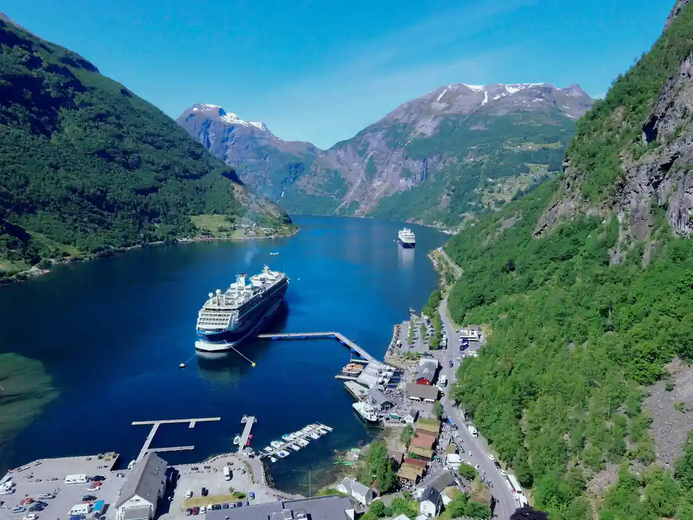
- The Geirangerfjord is a 15 kilometre side arm of the Sunnylvsfjorden, 258 metres at its deepest and 500 to 1,500 metres wide.[15]
- The West Norwegian Fjords were inscribed in 2005 for exceptional natural beauty and a diverse range of landscape formations.[13]
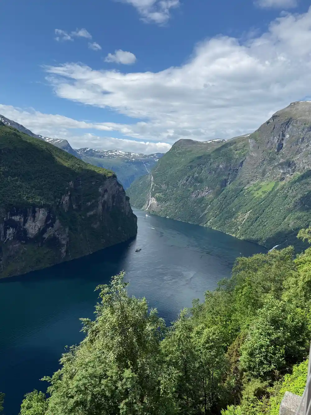
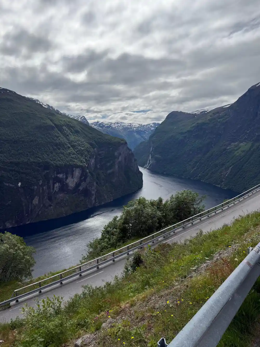
- During the last Ice Age glaciers re-moulded V-shaped valleys into U-shaped valleys with steep mountain sides.[13]
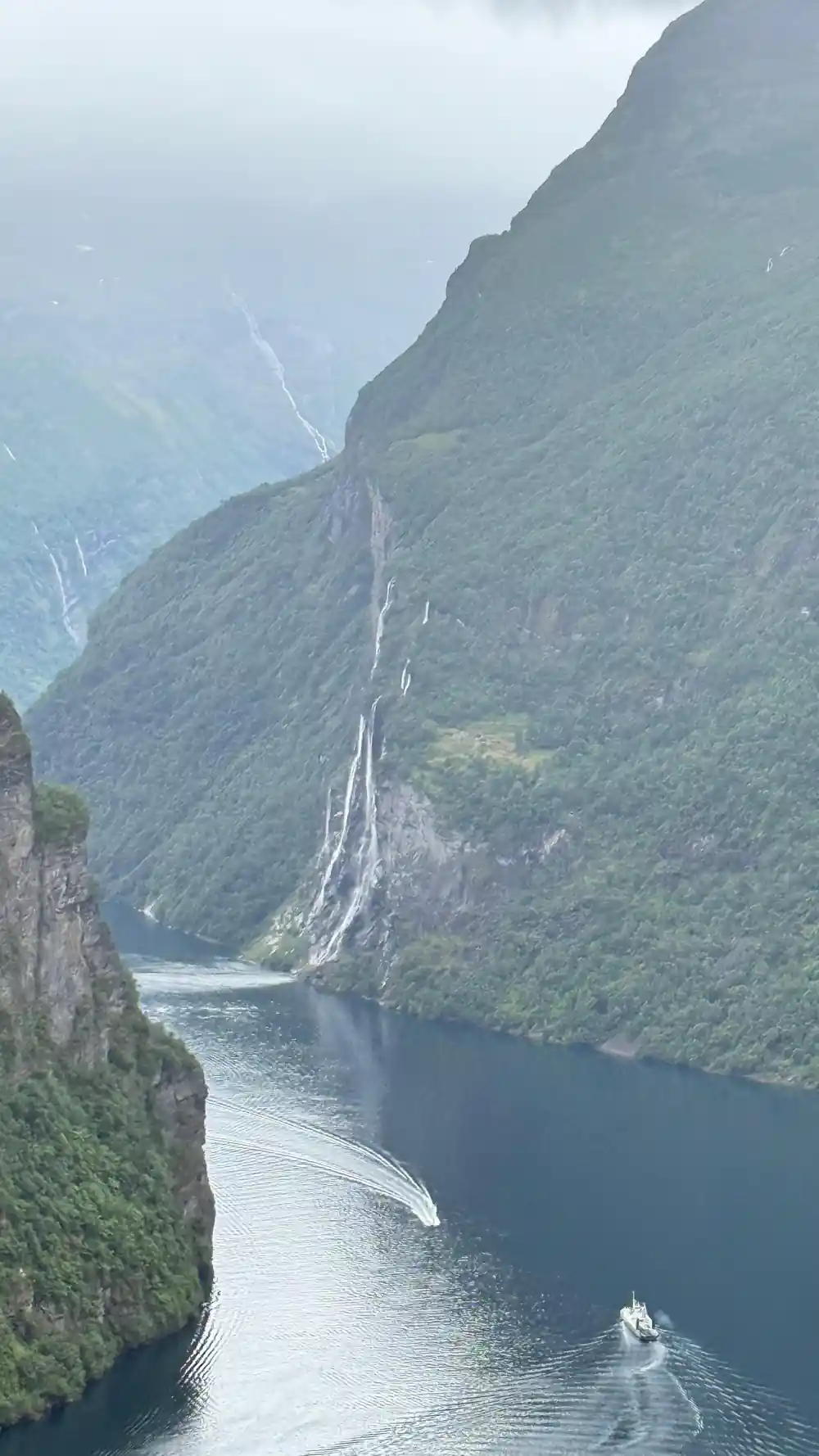
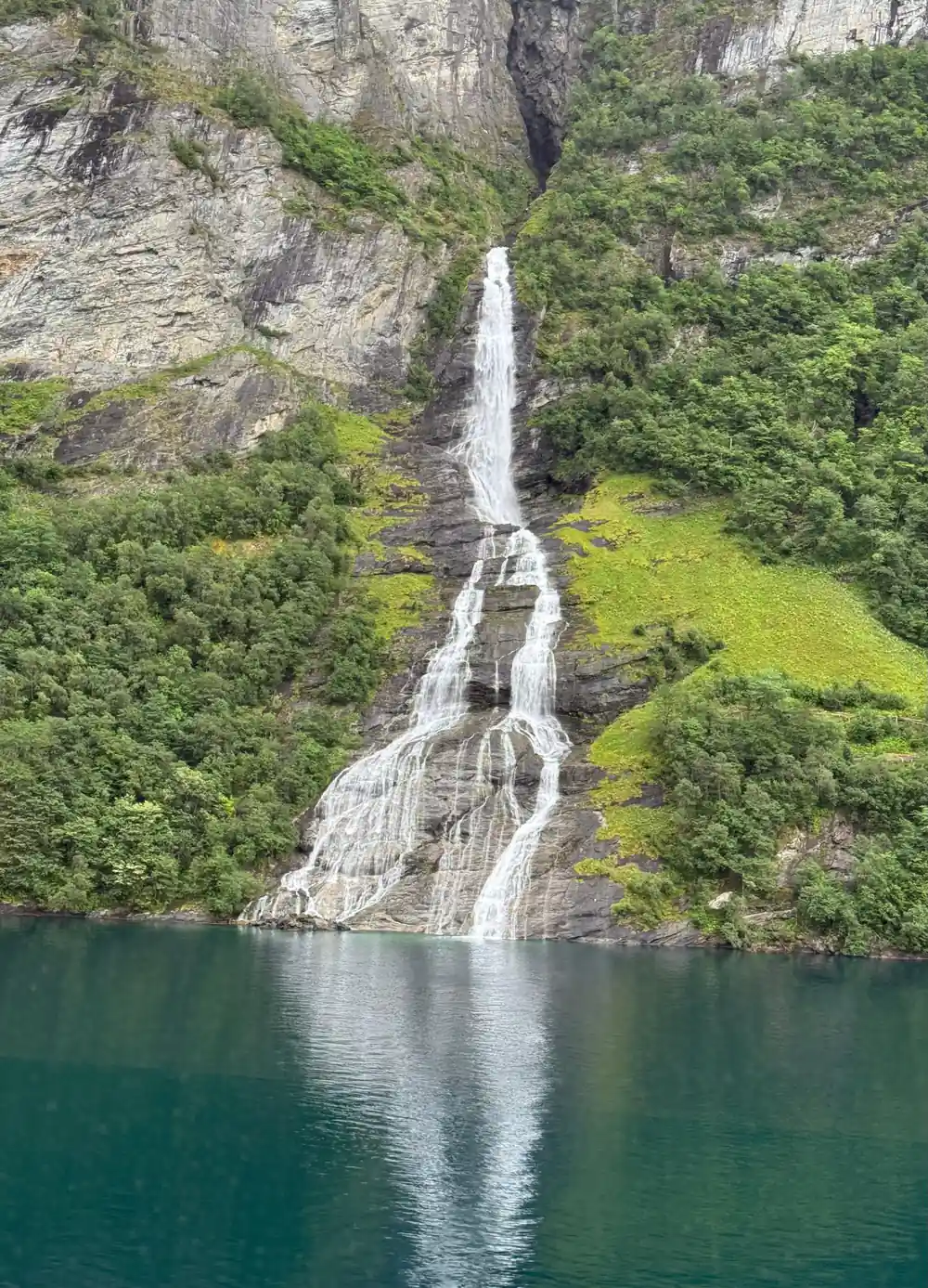
- Seven waterfalls plunge into the fjord at the abandoned farm Knivsflå, with the Suitor falling on the opposite side.[15]
- A fracture in the mountain at Åkerneset is widening by 2 to 8 centimetres a year and may eventually slide into the fjord.[14]
| The fjord | The waterfalls | The mountain farms | |
|---|---|---|---|
| What it is | A 15 km side arm of Sunnylvsfjorden[15] | Seven Sisters, Suitor, Bridal Veil[15] | Farms on shelves above the water[15] |
| How it formed | Ice eroded the valley below sea level[16] | Falls tumbling off steep valley walls[13] | Worked, then abandoned: Knivsflå in 1898[15] |
| A sourced number | 258 m at its deepest[15] | Highest Sister: 250 m free fall[18] | Blomberg: 450 m above sea level[15] |
| Where to see it | From the top of Dalsnibba[20] | From a sightseeing cruise[18] | Skageflå and Knivsflå from the boat[18] |
The ice re-moulded the V-shaped valleys into U-shaped valleys with steep mountain sides.
The two fjords, among the world's longest and deepest, are considered as archetypical fjord landscapes.
Seeing the World Heritage landscape for yourself
Look for on the way
How Glaciers Carved the Geirangerfjord
The Geirangerfjord with glacier activity shaped one of Norway's most dramatic landscapes over millions of years. During the last ice age, a massive glacier near Geiranger flowed downhill under its own weight, grinding and widening the valley floor as it moved toward the sea. Unlike a bay, which forms when ocean water floods a coastal depression, or a canyon, which rivers carve through rock over time, a fjord is the direct result of glacial excavation.
The ice did not simply flow; it scraped away at the bedrock with the force of thousands of tons, deepening the valley to depths far greater than any river could achieve. When the climate warmed and the ice retreated roughly 10,000 years ago, seawater rushed in to fill the empty trough, creating the fjord you see today. This process explains why Geirangerfjord plunges to 258 metres at its deepest point and stretches 15 kilometres inland, far deeper and longer than the surrounding valleys.
The geology tells a story of immense power. The vertical cliffs that rise 1,000 metres or more on either side of the water are not accidents of nature but the direct walls of the glacial valley, left exposed when the ice vanished. These walls are still revealing their past: waterfalls cascade down where meltwater from higher valleys finds its way to the fjord, and the pale striations visible on the rock face are glacial scratches left by the passage of rock-laden ice. Every feature you see on this guided tour, from the narrow passages between ridges to the U-shaped profile of the valley itself, bears the signature of glacial carving.
UNESCO Recognition and Natural Heritage
The Geirangerfjord earned UNESCO World Heritage status in 2005 because of its exceptional natural beauty and the clarity with which it demonstrates glacial geology. The Norwegian government nominated the fjord alongside the Nærøyfjord as a paired site, recognising that both represent outstanding examples of fjord formation and ongoing natural processes. UNESCO assessors noted the steepness of the landscape, the integrity of the ecosystem, and the scientific value of studying active rockfall, glacier retreat, and fjord ecology in one location. The listing drew international attention to a region that had been important to Norwegian identity for centuries but was not widely known outside Scandinavia. Today, the UNESCO designation protects the fjord from certain forms of industrial development and supports conservation efforts that keep the environment as close to pristine as possible.
The recognition also reflects the fjord's role in demonstrating how climate shapes geography. As global temperatures continue to shift, Geirangerfjord serves as a natural laboratory for understanding how landscapes respond to warming. Glaciers in the surrounding mountains are retreating, and researchers monitor these changes to understand broader climate trends. For visitors on the tour, the UNESCO status is a signal that what you are seeing is not merely scenic but scientifically significant and protected for future generations.
The listing rests on two natural qualities: exceptional natural beauty, and a significant, diverse range of landscape formations at the innermost reaches of two of the longest and deepest fjords in the world.[13] That is the Geiranger UNESCO World Heritage status in practice, shared with the Nærøyfjord about 120 kilometres away, and IUCN World Heritage Outlook rated the site's conservation outlook in 2025 as good with some concerns.[13][14]
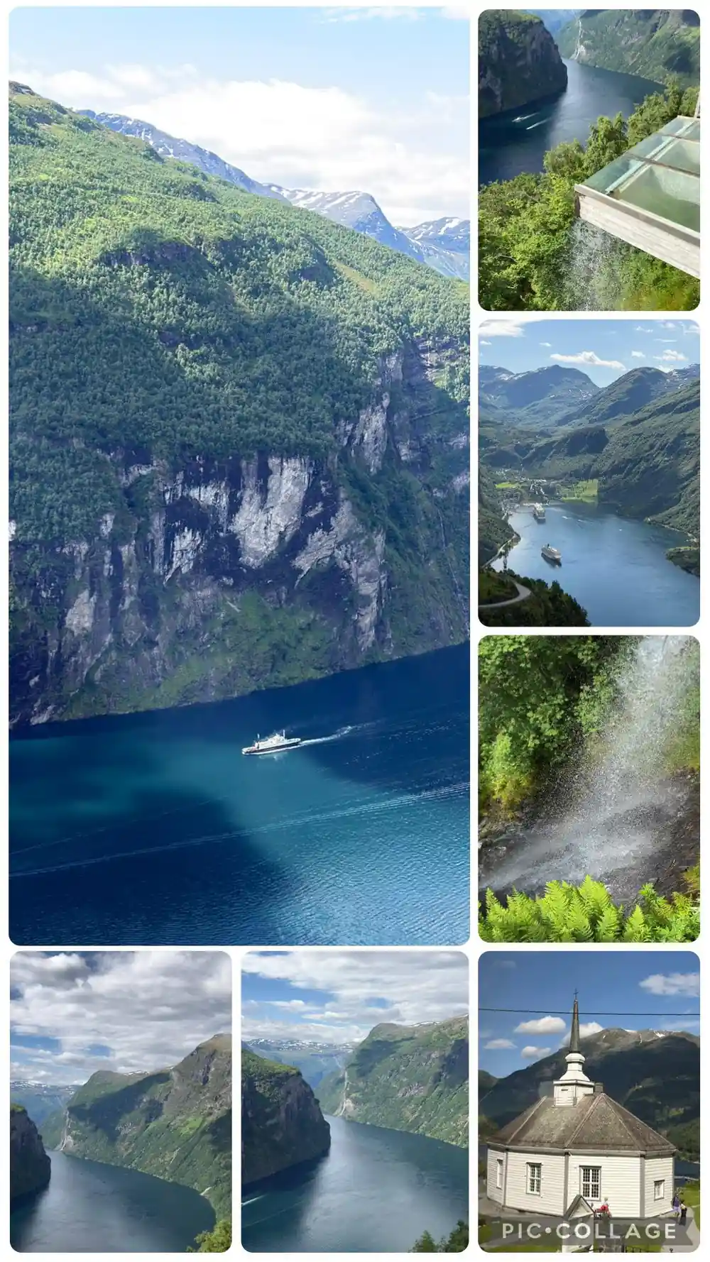
Waterfalls running down the steep walls of the Geirangerfjord
The Geirangerfjord Water: Colour and Cold
The distinctive pale turquoise colour of the water in Geirangerfjord comes from glacial meltwater. Glaciers grind rock into an extremely fine powder called glacial flour, and when this sediment enters the fjord, it suspends in the water column and scatters light in a way that creates the blue-green hue. The Geirangerfjord water temperature stays cool even in summer. This cold is not merely a feature of the season but a permanent characteristic caused by the continuous input of meltwater from the mountains and the depth of the fjord itself. Deep water in the fjord is slow to warm because sunlight cannot penetrate far, and the volume of water is so large that seasonal heating has little effect on the overall temperature.
Understanding the water's composition helps explain the ecology of the fjord. The cold, nutrient-rich meltwater creates conditions that support specific species of fish, plankton, and other marine life adapted to these parameters. The clarity and colour visible from Dalsnibba Skywalk or Flydalsjuvet View Point during your tour are direct results of the ongoing relationship between the surrounding glaciers, the rock they grind, and the water they feed into the fjord. On a clear day, you can see how the water colour shifts from paler turquoise near the glacier sources to deeper blue farther out, a visible map of where fresh meltwater enters the system.
Glaciers are still part of this landscape, and they are shrinking. For the glaciers of the West Norwegian Fjords World Heritage site, the mass loss relative to 2000 has been reported as 33.2 per cent.[14] One glacier near Geiranger is easy to pick out: from the summit of Dalsnibba the view takes in Blåbreen as well as the Geirangerfjord below.[20]
The Seven Sisters and the Legend of the Suitor
Norwegian folklore weaves a romantic and tragic tale into the landscape of Geirangerfjord. Seven waterfalls cascade down the cliffs on one side of the fjord, named the Seven Sisters in local tradition. According to legend, these represent seven sisters who fell in love with a suitor represented by another waterfall, the Suitor, which flows down the opposite cliff face. The Suitor waterfall is in pursuit, the story says, but will never quite reach the Sisters because the fjord lies between them. The tale has been part of Geiranger culture for generations, passed from guides to visitors and from parents to children, giving human narrative to the raw power of geology. While the legend is not historical fact, it reflects how communities make sense of dramatic natural features by connecting them to universal emotions and stories.
The waterfalls themselves are real geological phenomena. They form where streams and small rivers flowing from the high plateaus and glaciers above reach the cliff edge and plunge toward the fjord. The Bridal Veil waterfall has its source on Ystehornet and falls 300 metres into the fjord, and for a couple of weeks a year its meltwater makes a spray that looks like a bridal veil.[15] These waterfalls are most vigorous during spring and early summer when glacier melt is at its peak, and the Bridal Veil is not visible all year round.[15]
The seven falls plunge into the fjord beside the abandoned farm Knivsflå, the Suitor falls on the opposite side, and the Bridal Veil is found on the north side of the fjord.[15][17] The highest of the Sisters has a free fall of 250 metres, and according to the legend the Suitor tried to propose to the Seven Sisters from across the water, but never succeeded.[18]
250 m
Seven waterfalls plunge into the Geirangerfjord at Knivsflå, and the highest of them has a free fall of 250 metres.[15][18]
Rockfall and the Unstable Cliffs
The same forces that created the dramatic cliffs of Geirangerfjord continue to shape them today, and not always safely. The steep rock walls are prone to rockfall because of frost weathering, where water freezes and thaws in cracks, gradually forcing rock apart, and because of the sheer weight of stone pressing downward. The cliffs rise so steeply that even modest loosening of rock can send boulders tumbling toward the water. On 8 May 2017 a rockslide across the fjord from the Seven Sisters sent a wave that lifted the MS Geiranger about a metre in Geiranger, a reminder that this landscape is geologically active.[23] Researchers and local authorities monitor the cliffs for signs of instability, using instruments to measure movement and predict where the next major event might occur. This is not a fjord in stasis but a landscape in constant, slow transformation.
The ongoing rockfall also contributes to the fjord's ecology. Freshly exposed rock surfaces provide habitat for pioneering plants and fungi, and the debris that enters the water adds nutrients and sediment that support aquatic life. During your tour, your guide may point out recent scars on the cliff faces where rock has recently fallen, or areas where protective netting has been installed to catch falling debris before it reaches populated areas. Understanding that the fjord is an active geological system, not a static postcard, deepens appreciation for the forces constantly at work beneath the surface.
At Åkerneset, on the Sunnylvsfjorden, a fracture in the mountain is widening by 2 to 8 centimetres a year and may eventually slide into the fjord.[14] As much as 54 million cubic metres of rock could be involved; in that worst case the wave is modelled at 85 metres at Hellesylt and 70 metres at Geiranger, and NVE keeps the slope under continuous surveillance.[19]
Wildlife on the Fjord Cliffs
The near-vertical cliffs of Geirangerfjord host a surprising variety of wildlife despite their harsh appearance. Golden eagles nest on the high ledges, hunting the abundant seabirds that inhabit the fjord. Peregrine falcons also breed here, using the cliff faces as both home and hunting ground. At water level, cormorants and other diving birds feed on fish, while seals occasionally venture into the fjord from the coast. The cliff vegetation is sparse but specialised, with hardy alpine plants that can survive on minimal soil and exposure to wind. Some species found on these cliffs grow nowhere else in Norway, making the fjord a biodiversity hotspot despite its apparent bleakness. Lichen covers much of the rock, turning the grey stone into a patchwork of orange, yellow, and green, visible from the viewpoints on your tour.
The ecosystem of the fjord extends from the cliffs down to the water. The cold, nutrient-rich water supports populations of fish that in turn support the birds and mammals that depend on them. Jellyfish and other invertebrates thrive in the fjord's unique conditions, and the plankton communities that form the base of the food chain are specially adapted to the low temperature and glacial meltwater input. What appears from a distance as a barren rock wall is actually a complex, interconnected living system shaped by thousands of years of coexistence with the fjord's extreme conditions.
IUCN World Heritage Outlook names white-tailed eagle and golden eagle among the birds here, Eurasian otter and dipper along the free-flowing rivers, and salmon and sea trout in the water.[14] In the sea itself, harbour seals and porpoise live alongside several other species of cetaceans, and on land the mammal fauna comprises a wide range of ungulates and carnivores typical of the region.[14]
What the Newspapers Recorded Living Here
The larger animals have gone, and they went recently enough to have been reported in the press. In August 1894 the Haugesunderen carried a short notice that a wolf den had been found at Geiranger on the fifteenth of the month, that two adult wolves had been shot, and that one cub had been taken alive [1].
Bears lasted longer. In June 1934 Sunnmørsposten described the men of Geiranger being alerted and going up to Korsmyra to head off a bear that the men of Eidsdal were driving toward them [2]. Korsmyra sits at the high point of the road you will travel toward Dalsnibba.
Neither animal is a realistic sight today. What the two notices establish is how thinly settled and how wild this valley was within living memory of the buildings you will see in the village.
Experiencing the Fjord: What to Expect on Your Tour
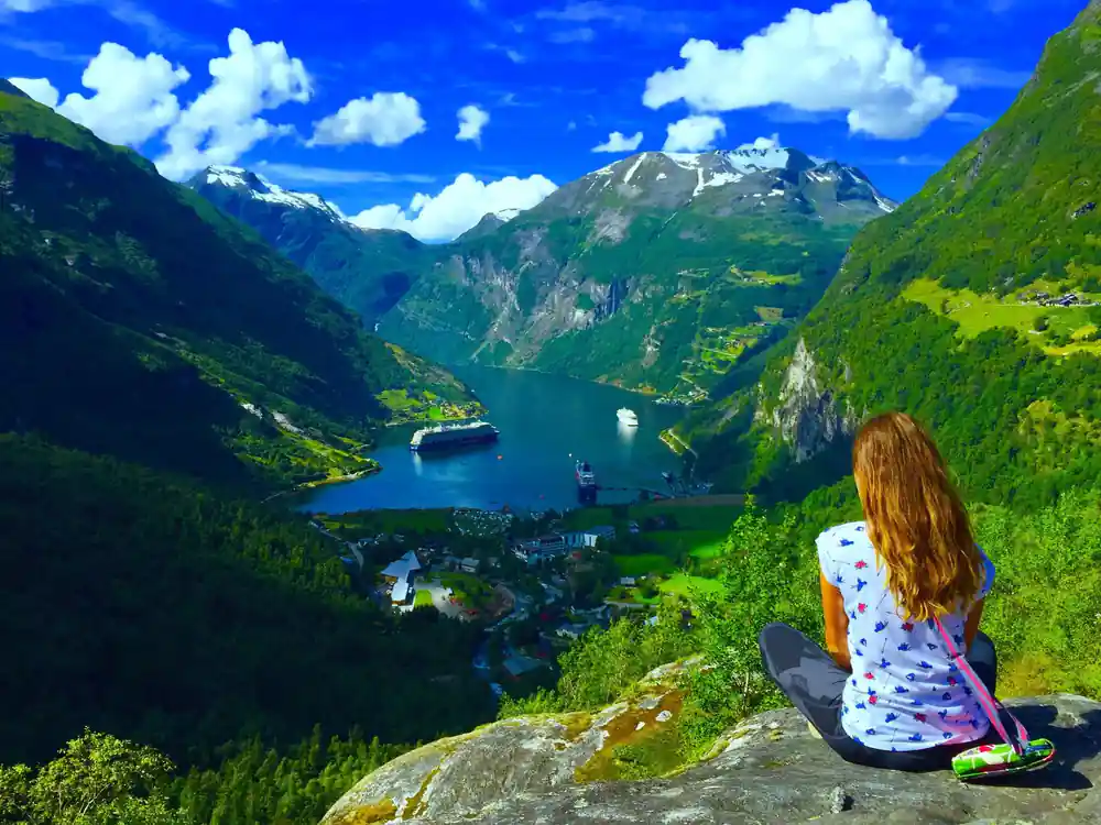
Your 3-hour-30-minute guided bus tour takes you to four key viewpoints designed to show the full scope of the fjord's natural wonders. Flydalsjuvet View Point offers a perspective looking down into the fjord from above, revealing the full width and length of the waterway and the scale of the cliffs. From Dalsnibba Skywalk, on the 1,476-metre summit, you gain a panoramic vista that shows not only the fjord but the surrounding mountains and valleys, contextualising Geirangerfjord within the broader landscape.[24]
Eagle Bend provides a dramatic close-up view of the water and the cliff faces, where you may spot waterfalls and wildlife. Djupvatnet Lake sits high above the fjord, offering a quiet mountain environment that contrasts with the fjord's grandeur. Throughout the tour, your guide provides interpretation that connects what you see to the geological processes, human history, and ecological realities that make Geirangerfjord one of the world's most remarkable fjords.
The tour is structured to move through the landscape in a logical sequence, allowing you to understand how glaciers carved the valley, how the fjord formed when ice retreated, and how ongoing processes continue to shape the environment. Photo stops are built into the itinerary at each location, giving you time to capture the views and absorb the scale of the surroundings. The guided format means you have access to local expertise and insights that enhance observation, whether you are learning about the geology, the wildlife, or the cultural significance of the landscape. Whether you are a first-time visitor or returning to Geirangerfjord, the tour reveals layers of meaning in what might otherwise appear as simply a beautiful view.
How high the World Heritage landscape climbs
Heights in metres above sea level for points in and around the Geirangerfjord.[13][15][18][20]
Price a World Heritage day in Geiranger
Every figure is a "from" price for one adult from each GetYourGuide listing, not a quote. Child prices may differ, so check the listing for your own party.
When the World Heritage sights are open
Reading the fjord landscape
Start at the Fjord Centre
Its exhibitions explain how the landscape was formed and how natural forces still affect it.[21]
Look down from Flydalsjuvet
Flydalsjuvet is the first stop on the coach tour, ahead of Dalsnibba, Djupvatnet and Eagle Bend.
Stop at Djupvatnet
The lake sits at 1,030 metres, where the toll road up Dalsnibba begins.[20]
Find the glacier from Dalsnibba
From the summit the view takes in the Blåbreen glacier and the Geirangerfjord.[20]
See the falls from the water
A sightseeing cruise passes the Seven Sisters, the Suitor and the Bridal Veil.[18]
See the glacier-cut valley from Flydalsjuvet and Dalsnibba
from US$117Reserve now & pay later